ECE Research Seminar – October 17, 12-1 p.m.
October 8, 2025
Please join us for our October 2025 ECE Research Seminar
October 17, 2025, Friday 12:00-1:00 PM, Simrall 228
https://msstate.webex.com/msstate/j.php?MTID=mf630fcbd52ff0749df717aa2ed25a62f
Active, Passive, and Everything in Between: Radio Waves for Science in Mississippi and Beyond
Dylan Ray Boyd | boyd@ece.msstate.edu
Abstract: In the last decade, several advancements have changed the landscape of microwave remote sensing. Following the continued success of NASA’s Soil Moisture Active/Passive radar and radiometer, international space agencies have invested in the use of global navigation satellite systems (GNSS) for remote sensing by measurement of their reflections across land and water bodies with example systems such as NASA’s CYGNSS and ESA’s HydroGNSS missions. This GNSS-reflectometry technology provides near-constant L-band illumination from any point along the globe which enables remote sensing scientists everywhere to affordably leverage forward scattering properties of L-band radar signals. While this technology has developed, small satellite technology has become affordable enough for private institutions to develop low-cost SAR systems at X-band. These systems offer on-demand, high-resolution SAR imagery for both stripmap and centimeter-resolution spotlight imagery from several major vendors. Simultaneously, the recent launches of NASA and ISRO’s L-band SAR mission NISAR and ESA’s P-band SAR instrument Biomass will offer unprecedented, high-resolution imagery of frequencies that offer significant penetration through vegetation canopies and will enable new techniques for soil moisture remote sensing, topography analysis, and much more. This seminar will discuss these technologies and methods for leveraging them at Mississippi State University. Example applications will include the modeling and simulation of L-band systems for the study of soil moisture and changes in vegetation optical depth through forested canopies, the processing and leveraging of MIMO radar/radiometer systems for the remote sensing of snow and potential precision agriculture applications. Through modeling analysis and hardware development, this seminar will discuss routes that can combine these new satellite remote sensing technologies with custom ground-scale instruments for advancing the state of art in radar remote sensing.
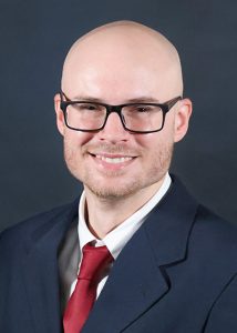
 Dr. Dylan Ray Boyd is an assistant professor in Electrical and Computer Engineering at Mississippi State University. His primary area of research is the use of microwave modeling and field experiments to leverage SAR, GNSS-R, and radiometry for applications of precision agriculture, soil moisture remote sensing, forest remote sensing, and snow water equivalent (SWE) retrieval. He has extensive experience in applied electromagnetic modeling for ground-, air-, and space-scale bistatic scattering. Dr. Boyd was a recipient of a NASA FINESST 2021 award and has previously served as a postdoctoral researcher at NASA Goddard Space Flight Center where he modeled, collected, and processed radar and radiometer data.

* For further information, contact:
Dr. Jenny Du | du@ece.msstate.edu | 5-2035
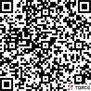
For WebEx access, scan the QR code
